Западная сахара
Содержание:
Эль-Аюн
Других достопримечательностей в Западной Сахаре, которые могли бы представлять хоть какой-то интерес, не много. В крупнейшем городе региона — Эль-Аюне (управление Марокко) — можно увидеть давно не действующий христианский собор, построенный испанцами в стиле ар-деко; большую мечеть; ремесленный рынок; исторический музей и развалины форта испанских времен.
Эль-Аюн не столица, но крупнейший город региона. Бледные оттенки розового и оранжевого покрывают все строения, однако красочные настенные рисунки добавляют красок городу. Большинство граффити — это живописное искусство профессиональных художников. Некоторые изображения могут быть интересными с точки зрения истории: картина «Зеленый марш» возле Мечуара; массовая демонстрация 1975 года, когда Марокко заставило Испанию отказаться от своей колонии; несколько других настенных росписей, изображающих исторические события до Зеленого марша. Пожалуй, эти уличные фрески, которые можно встретить и в других городах, являются одними из лучших туристических достопримечательностей этой части африканской пустыни.
Geography
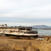
Western Sahara is bordered by Morocco to the north, Algeria in the northeast, Mauritania to the east and south, and the Atlantic Ocean on the west. The land is some of the most arid and inhospitable on the planet, but is rich in phosphates in Bou Craa. The largest city is El Aaiún (Laayoune), which is home to two-thirds of the population.
NASA photo of El Aaiún.
Saguia el Hamra is the northern third and includes Laayoune. Río de Oro is the southern two-thirds (south of Cape Bojador), with the city of Dakhla. The peninsula in the extreme southwest, with the city of Lagouira, is called Ras Nouadhibou, Cap Blanc, or Cabo Blanco. The eastern side is part of Mauritania.
The climate is hot, dry desert; rain is rare; cold offshore air currents produce fog and heavy dew. Hot, dry, dust/sand-laden sirocco winds can occur during winter and spring; widespread harmattan haze exists 60 percent of the time, often severely restricting visibility.
The terrain is mostly low, flat desert with large areas of rocky or sandy surfaces rising to small mountains in the south and northeast. Along the coast, steep cliffs line the shore, and shipwrecks are visible. The lowest point is Sebjet Tah (-55 m) and the highest point (unnamed) is 463 m. Natural resources are phosphates and iron ore. Water and arable land are scarce.
Plant and animal life is restricted to those species adapted to desert conditions, such as fennec foxes, jerboas and other rodents, and hyenas. Reptiles include lizards and snakes.
Освободительное движение
Последующая история Западной Сахары связана с борьбой за независимость от испанского, марокканского и мавританского владычества.
- 1957 год: освободившееся в 1956 году от испанской колонизации Марокко выдает многовековые претензии на земли Западной Сахары.
- В 1965 году ООН призывает к деколонизации этой территории.
- 1973 год: основано движение независимой Сахары — Фронт Полисарио.
- 1975 год: король Марокко опровергает решение Гааги в пользу права Сахары на самоопределение и организует «зеленый марш» — демонстрацию, когда 350 000 марокканцев вошли в Западную Сахару. Испания выводит свою администрацию и отказывается на территориальные права в этом регионе.
- 1975-1976 годы: Марокко присоединяет две трети Западной Сахары. Партизаны Полисарио объявляют САДР с правительством, действующим в изгнании, на территории Алжира. Тысячи сахарских беженцев перебираются в Западный Алжир и недалеко от города Тиндуфа устанавливают временные палаточные поселения. С 1976 года земли Западной Сахары разделены между Мавританией и Марокко. С 1979 года территория была в основном захвачена Марокко, неоккупированной оставалось около 20 % так называемой Свободной зоны на востоке.
- 1975 год: начинается 16-летняя партизанская война Фронта Полисарио против марокканских сил.
- 1979 год: Мавритания отказывается на территориальные притязания в Западной Сахаре, оставляя право присоединить свою долю земель Марокко.
- С 1991 года прекращены боевые действия. После многочисленных переговоров, курируемых ООН, была принята резолюция относительно референдума, на котором решится окончательная судьба Западной Сахары: полная независимость или присоединение к Марокко. Из-за разногласия сторон референдум пока не проведен.
- В 2016-м скончался долгосрочный лидер САДР Мохаммед Абдельазиз.
Demographics
The indigenous population of Western Sahara is known as Sahrawis. These are Hassaniya-speaking tribes of mixed Arab-Berber heritage, effectively continuations of the tribal groupings of Hassaniya-speaking Moorish tribes extending south into Mauritania and north into Morocco as well as east into Algeria. The Sahrawis are traditionally nomadic bedouins, and can be found in all surrounding countries.
As of July 2004, an estimated 267,405 people (excluding the Moroccan army of some 160,000) live in the Moroccan-controlled parts of Western Sahara. Morocco brought in large numbers of settlers in anticipation of a UN-administered referendum on independence. While many of them are from Sahrawi tribal groups living in southern Morocco, others are non-Sahrawi Moroccans from other regions. The settler population is today thought to outnumber the indigenous Western Sahara Sahrawis. The precise size and composition of the population is subject to political controversy.
The Polisario-controlled parts of Western Sahara are barren and have no resident population, but they are traveled by small numbers of Sahrawis herding camels, going back and forth between the Tindouf area and Mauritania. However, the presence of mines scattered throughout the territory by both the Polisario and the Moroccan army makes it a dangerous way of life.
The Spanish census and MINURSO
A 1974 Spanish census claimed there were some 74,000 Sahrawis in the area at the time (in addition to approximately 20,000 Spanish residents), but this number is likely to be on the low side, due to the difficulty in counting a nomad people, even if Sahrawis were by the mid-1970s mostly urbanized.
In 1999 the United Nations’ MINURSO mission announced that it had identified 86,425 eligible voters for the referendum that was supposed to be held under the 1991 settlement plan. By «eligible voter» the UN referred to any Sahrawi over 18 years of age that was part of the Spanish census or could prove his/her descent from someone who was. These 86,425 Sahrawis were dispersed between Moroccan-controlled Western Sahara and the refugee camps in Algeria, with smaller numbers in Mauritania and other places of exile. These numbers cover only Sahrawis «indigenous» to the Western Sahara during the Spanish colonial period, not the total number of «ethnic» Sahrawis (i.e, members of Sahrawi tribal groupings), who also extend into Mauritania, Morocco, and Algeria.
The Polisario declares the number of Sahrawis living in the Tindouf refugee camps in Algeria to be approximately 155,000. Morocco disputes this number, saying it is exaggerated for political reasons and to attract more foreign aid. The UN uses a number of 90,000 «most vulnerable» refugees as the basis for its food aid program.
Status of refugees
Sahrawi refugees began arriving in Algeria in 1976 after Spain withdrew from the Western Sahara and fighting broke out over its control. Most of the Sahrawi refugees have been living for more than 30 years in the desert regions of Tindouf. Some of the Sahrawis stayed in the Western Sahara, however, and families remain separated.
In September 2007, the UN refugee agency said it feared that a lack of funding could bring a halt to confidence-building measures connecting Sahrawi refugees in Algeria and their relatives in the Western Sahara. In January 2007, UNHCR had appealed for nearly US $3.5 million to continue the family visits and telephone services initiated in 2004. «But with only a little over half of the appeal funded so far, the whole operation risks being stopped next month ,» the UNHCR said.
A total of 154 visits have taken place involving 4,255 people – mainly women. An additional 14,726 people are waiting to take part in the program. Almost 80,000 calls have been placed in four refugee camps in Algeria with telephone centers.
Доисторическое искусство
Как и в других регионах Сахары, самыми впечатляющими достопримечательностями здесь являются участки с древнейшими наскальными изображениями.
- Bou Dheir — местность с многочисленными скальными укрытиями, где можно увидеть разнообразные доисторические картины, немалая часть которых в хорошем состоянии. Многие рисунки очень большие, изображающие диких животных и людей. На плато над укрытиями находится большая каменная структура в форме полумесяца.
- Cueva del Diablo — доисторическое убежище, пещера с выгравированными изображениями. Некоторые из них являются самыми впечатляющими для этой части мира.
- Эркейзское наскальное искусство — участок, названный парком «Эркез», который находится в северной части Западной Сахары, недалеко от Тифарити, временной столицы САДР, контролируемой Полисарио. Здесь сохранилось около сотни пещер периода каменного века с богатой коллекцией изображений диких животных, крупного рогатого скота, людей. А также здесь найдены могильные насыпи и мегалитические стелы, то есть обработанные несколько тысячелетий назад вертикальные камни. Эти изделия и наскальная живопись были созданы около 15-12 тысячелетий назад. Место подвергается постоянным разграблениям.
- Lejuad-Tiris — богатое сосредоточение остатков неолитических поселений с погребальными памятниками, впечатляющими гранитными монолитами, наскальными изображениями, расположенное на юге региона.
- Rekeiz Lemgasem — ценнейший участок древнего искусства с мегалитами и погребальными памятниками, где обнаружено более 80 доисторических пещер с наскальной живописью.
- Sluguilla Lawash — место, очень богатое наскальными рисунками, расположенное вдоль сухого русла Laauach Tel-li. Большинство изображений показывает диких животных: жирафов, носорогов, слонов. Ноги нарисованных животных часто выглядят неестественно удлиненными. Участок также содержит многочисленные доисторические курганы конической формы.
Туристический интерес
Для комфортного путешествия и расслабленного отдыха Западная Сахара совершенно не приспособлена. Край относится к одному из беднейших регионов планеты, туристическая инфраструктура здесь никак не развита, поскольку в эту сферу бизнеса никто не спешит вкладывать средства из-за многолетней политической нестабильности региона. На побережье не найдется комфортабельных отелей, а пляжей для купания и загара и вовсе нет. Только в наиболее населенных городах найдутся пункты с интернетом. А остановившись в отеле, даже не всегда можно подзарядить мобильный телефон.
Однако смелые, неунывающие туристы добираются и сюда. На что они рассчитывают? Прежде всего люди хотят лицезреть девственную красоту Сахары, воочию увидеть образцы доисторического наскального искусства, которым богата эта пустыня, полюбоваться природными красотами и артефактами, оставшимися лишь в малонаселенных частях планеты. Однако на машине в такие места чаще всего добраться невозможно из-за отсутствия дорог.
Politics
Police checkpoint at suburbs of Laayoune.
The legal status of the territory and the question of its sovereignty remains unresolved; it is considered a non-self-governed territory by the United Nations.
The Morocco-controlled parts of Western Sahara are divided into several provinces treated as integral parts of the kingdom. The Moroccan government heavily subsidizes the Saharan provinces under its control with cut-rate fuel and related subsidies, to appease nationalist dissent and attract immigrants -or settlers-from loyalist Sahrawi and other communities in Morocco proper.
The exiled government of the self-proclaimed Sahrawi Arab Democratic Republic (SADR) is a form of single-party parliamentary and presidential system, but according to its constitution, this will be changed into a multi-party system at the achievement of independence. It is presently based at the Tindouf refugee camps in Algeria, which it controls. It also claims to control the part of Western Sahara to the east of the Moroccan sand wall. This area is more or less unpopulated and the Moroccan government views it as a no-man’s land patrolled by UN troops.
Human rights
Both Morocco and the Polisario accuse each other of violating the human rights of the populations under their control, in the Moroccan-controlled parts of Western Sahara and the Tindouf refugee camps in Algeria, respectively. Morocco and organizations such as France Libertés consider Algeria to be directly responsible for any crimes committed on its territory, and accuse the country of having been directly involved in such violations.
Morocco has been repeatedly criticized by international human rights organizations such as Amnesty International. Polisario has received criticism on its treatment of Moroccan prisoners-of-war, and on its general behavior in the Tindouf refugee camps. A number of former Polisario officials who have defected to Morocco accuse the organization of abuse of human rights and sequestration of the population in Tindouf.
According to the pro-Morocco Moroccan American Center for Policy, Algeria is the primary financial, political, and military supporter of the Polisario Front. Though Libya and countries of the former Soviet bloc historically backed Polisario, their support has decreased since the end of the Cold War.
Sahrawi refugees in the Tindouf camps depend on humanitarian aid donated by several UN organizations as well as international non-governmental organizations. It is widely believed that much of this humanitarian aid never reaches those it is intended to assist because it is sold on the black market in neighboring countries by Polisario. While many in the international community have called for a census and an audit system to ensure the transparent management of the humanitarian aid, to date Polisario has not allowed either a census or independent oversight of its management of humanitarian assistance.
Cuba also supports the Polisario Front and has been accused of kidnapping Sahrawi youth from the refugee camps and sending them to Castro’s Island of Youth, where they are inundated with anti-Western, Marxist-Leninist teachings. The Polisario Front’s objective for the deportation of Sahrawi children is said to be 1) to separate families and 2) to keep pressure on family members who remain in the camps to go along with Polisario leadership so as not to endanger their children’s welfare.
Administrative division
Tifariti, in the Free Zone, east of the Moroccan Berm.
The Western Sahara was partitioned between Morocco and Mauritania in April 1976, with Morocco acquiring the northern two-thirds of the territory. When Mauritania, under pressure from Polisario guerrillas, abandoned all claims to its portion in August 1979, Morocco moved to occupy that sector shortly thereafter and has since asserted administrative control over the whole territory. The official Moroccan government name for Western Sahara is the «Southern Provinces,» which indicates Río de Oro and Saguia el-Hamra.
Not under control of the Moroccan government is the area that lies between the sand wall and the actual border with Algeria. The Polisario Front claims to run this as the Free Zone on behalf of the SADR. The area is patrolled by Polisario forces, and access is restricted, even among Sahrawis, due to the harsh climate, the military conflict, and the abundance of land mines.
The Polisario forces (of the Sahrawi People’s Liberation Army, or SPLA) in the area are divided into seven «military regions,» each controlled by a top commander reporting to the president of the Polisario-proclaimed Sahrawi Arab Democratic Republic.
Длиннейшая минная преграда
В Западной Сахаре есть два объекта, которые лидируют своими размерами не только в Африке, но и в мире. Эти современные сооружения нельзя назвать привлекательными для туризма, поскольку одно из них относится к военной обороне, а другое к промышленному оборудованию.
Марокканская стена — ограждение длиной около 2700 км, возведенное в 1981-1987 годах. Оно разделяет две зоны: подвластную Марокко и контролируемую Полисарио. Стена является каменисто-земляными валами до трех метров высотой, оцепленными колючей проволокой, обустроенными артиллерийскими постами, системой патрулирования, радарными мачтами и другими средствами военного наблюдения и охраны. По всей длине с обеих сторон эта нехитрая конструкция обложена минами. Сооружение также называют «Западно-Сахарской обочиной» и «Стеной позора».
Sources and Further Reading
- Hodges, Tony. 1983. Western Sahara: the roots of a desert war. Westport, CT: L. Hill. ISBN 9780882081519
- Jensen, Erik. 2005. Western Sahara: anatomy of a stalemate. International Peace Academy occasional paper series. Boulder, CO: Lynne Rienner Publishers. ISBN 1588263053
- Mayhew, Bradley, and Jan Dodd. 2003. Morocco. Melbourne: Lonely Planet. ISBN 1740593618 and ISBN 9781740593618
- Pazzanita, Anthony G., and Tony Hodges. 1994. Historical dictionary of Western Sahara. African historical dictionaries, no. 55. Metuchen, NJ: Scarecrow Press. ISBN 0810826615
- Radu, Michael. September, 2007. Struggle in the Sandbox: Western Sahara and the «International Community». Foreign Policy Research Institute. Retrieved September 26, 2007.
- Shelley, Toby. 2004. End game in the Western Sahara: what future for Africa’s last colony? London: Zed. ISBN 1842773410
Economy
Aside from its rich phosphate deposits and fishing waters, Western Sahara has few natural resources and lacks sufficient rainfall for most agricultural activities. There is speculation that there may be rich off-shore oil and natural gas fields, but the debate persists as to whether these resources can be profitably exploited, and if this would be legally permitted due to the ambiguous status of Western Sahara.
Western Sahara’s economy is centered around nomadic herding, fishing, and phosphate mining. Most food for the urban population is imported. All trade and other economic activities are controlled by the Moroccan government. The government has encouraged citizens to relocate to the territory by giving subsidies and price controls on basic goods. These heavy subsidies have created a state-dominated economy in the Moroccan-controlled parts of Western Sahara, with the Moroccan government as the single biggest employer. Incomes in Western Sahara are substantially below the Moroccan level.
Morocco and the EU signed a four-year agreement in July 2006 allowing European vessels to fish off the coast of Morocco, including the disputed waters off the coast of Western Sahara.
After reasonably exploitable oil fields were located in neighboring Mauritania, speculation intensified on the possibility of major oil resources being located off the coast of Western Sahara. Despite the fact that findings remain inconclusive, both Morocco and Polisario have made deals with oil and gas exploration companies. In 2002, the head of the UN’s Office of Legal Affairs issued a legal opinion on the matter stating that while «exploration» of the area was permitted, «exploitation» was not.
Culture
The major ethnic group of the Western Sahara are the Sahrawis, a nomadic or bedouin tribal or ethnic group speaking a Hassaniya dialect of Arabic, also spoken in much of Mauritania. They are of mixed Arab-Berber descent but claim descent from the Beni Hassan, a Yemeni tribe that is supposed to have migrated across the desert in the eleventh century.
Physically indistinguishable from the Hassaniya-speaking Moors of Mauritania, the Sahrawi people differ from their neighbors partly due to different tribal affiliations (as tribal confederations cut across present modern boundaries) and partly as a consequence of their exposure to Spanish colonial domination. The surrounding territories were generally under French colonial rule.
Like other neighboring Saharan Bedouin and Hassaniya groups, the Sahrawis are Muslims of the Sunni sect and the Maliki law school. Local religious custom is, like other Saharan groups, heavily influenced by pre-Islamic Berber and African practices, and differs substantially from urban practices. For example, Sahrawi Islam has traditionally functioned without mosques in the normal sense of the word, in an adaptation to nomadic life.
The originally clan- and tribe-based society underwent a massive social upheaval in 1975, when a part of the population settled in the refugee camps of Tindouf, Algeria. Families were broken up by the flight.
The Moroccan government has invested in the social and economic development of the region of Western Sahara it controls, with special emphasis on education, modernization, and infrastructure. Laayoune (El-Aaiun) in particular has been the target of heavy government investment and has grown rapidly. Several thousand Sahrawis study in Moroccan universities. Literacy rates are about 50 percent of the population.
Небывалый конвейер
Другой «чемпион» относится к производственной сфере. От одного из промышленных городов Западной Сахары — Бу-Краа, где находятся крупнейшие разработки фосфатов, проходит конвейер, который считается самым длинным в мире. 98-километровая лента связывает порт Эль-Марса с городскими рудниками. Во время партизанских войн Полисарио конвейер и город неоднократно подвергались нападениям, и лента не раз была разрушена. Сейчас, после возведения стены, объект находится в зоне управления Марокко и продолжает работать.
Совершенно невозможно предсказать, когда в Западной Сахаре наступит политическая стабильность и как разрешится территориальный вопрос. Поэтому регион пока остается недоступным для массового туризма. Возможно, когда-нибудь бескрайнее побережье станет круглогодичным курортом с бесконечными пляжами, лучшим местом для серфинга, дайвинга и всех мыслимых видов морского отдыха. Появятся благоустроенные отели, кафе и рестораны, пройдут маршруты к многочисленным доисторическим памятникам, которыми щедра Сахара, и эта земля станет благоприятной для вездесущих туристов.
Credits
New World Encyclopedia writers and editors rewrote and completed the Wikipedia article
in accordance with New World Encyclopedia standards. This article abides by terms of the Creative Commons CC-by-sa 3.0 License (CC-by-sa), which may be used and disseminated with proper attribution. Credit is due under the terms of this license that can reference both the New World Encyclopedia contributors and the selfless volunteer contributors of the Wikimedia Foundation. To cite this article click here for a list of acceptable citing formats.The history of earlier contributions by wikipedians is accessible to researchers here:
Western Sahara history
The history of this article since it was imported to New World Encyclopedia:
History of «Western Sahara»
Note: Some restrictions may apply to use of individual images which are separately licensed.
Notes
- «Regions and Territories: Western Sahara», BBC News, 9 December 2011. Retrieved January 17, 2012.
- «Q&A: Western Sahara Clashes», BBC News, 8 November 2010. Retrieved January 17, 2012.
- Jensen, Erik (2005). , International Peace Academy Occasional Paper Series. Lynne Rienner Publishers. ISBN 1588263053. Retrieved January 17, 2012.
-
Department of Economic and Social Affairs
Population Division (2009). World Population Prospects, Table A.1. Retrieved January 17, 2012. - Ahmed R. Benchemsi and Mehdi Sekkouri Alaoui. Au cœur du polisario. Telquel. Retrieved January 17, 2012. «Tout cela se paie en dinars algériens»
Историческое и культурное формирование
К средневековому периоду на северо-западе Африки обитало несколько коренных народностей, среди которых выделялось кочевое население санхаджи и лемтуны, относящиеся к берберским племенам. Приход ислама в VIII веке на Магриб (североафриканская территория) сыграл важную роль в развитии региона. При активном развитии торговли Западная Сахара стала одним из караванных маршрутов между Марракешем в Марокко и Томбукту в Мали.
В XI веке менее 200 человек из арабов Макила поселились в марокканской долине реки Драа. Совместно с санхаджи и лемтунами они заключили союз, в итоге основав династию Альморавидов. Постепенно их владычество распространилось на большую часть Северной Африки. Западная Сахара по-прежнему оставалась важным торговым трактом. Примерно за пять столетий путем сложного процесса аккультурации и смешения некоторых коренных берберских племен с народами арабского происхождения сформировалась уникальная для Магриба культура.
Ландшафт
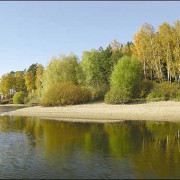
Знойный пустынный климат Западной Сахары заметно смягчается у побережья благодаря холодному влиянию Канарского течения. Регион характеризуется скалистым ландшафтом, обширными песчаными дюнами, захватывающими видами береговой линии Атлантического океана.
Пейзаж с верблюжьей травой на севере доминирует над сахарскими песчаными дюнами. Местные жители называют такой рельеф «хамадой». Он простирается на 200 км между Тифарити и Эль-Аюном. Пески сменяются скалами, долинами и скудной растительностью. Более 70 процентов Сахары — это «хамада». Здесь можно увидеть верблюдов, пасущихся на участках, покрытых разновидностью жесткой травы, которая вырастает более метра в высоту, редкие оазисы и многочисленные сухие русла рек, наполняющиеся водой лишь в период дождей.